
An Extinct Volcano on the Kenyan Border
Mount Elgon National Park protects the Ugandan slopes of an enormous extinct shield volcano straddling the border with Kenya, its eroded caldera ranking among the largest in the world at roughly forty kilometers across. Unlike Uganda’s other major mountain destinations, Elgon’s appeal extends well beyond its Wagagai Peak summit trek, encompassing salt-mining elephant caves, dramatic waterfalls, hot springs, and a montane forest ecosystem that shifts through several distinct vegetation zones as elevation increases. This guide covers the park’s broader attractions and practical planning details, complementing a more detailed, dedicated look at the full summit trek itself, covered separately in full elsewhere.
Mount Elgon was gazetted as a national park in 1993, and its slopes support a substantial population living directly on its lower reaches, particularly the Bagisu people, whose Imbalu circumcision ceremony and Arabica coffee farming culture are closely tied to the mountain’s fertile volcanic soil.
The Elephant Caves
Mount Elgon’s most unusual attraction is a series of caves, including the well-known Kitum Cave, where elephants have carved out tunnels over generations by mining salt deposits from the cave walls with their tusks, a behavior documented nowhere else in quite the same way. Visiting these caves, accessible via guided walks from the park’s Budadiri or Kapkwai trailheads, offers a genuinely unusual wildlife-adjacent experience distinct from anything else on Uganda’s standard safari circuit, though elephant sightings within the caves themselves are opportunistic rather than guaranteed on any given visit. Kitum Cave stretches roughly 200 meters into the mountainside, and guided visits typically cover the accessible sections where the elephants’ tusk marks are clearly visible gouged into the cave walls, a strange and striking sight that photographs capture only partially compared to seeing the scale of the excavation in person. Buffalo and antelope have also been documented using the caves for the same salt-mining purpose, though far less frequently and predictably than the resident elephant population.
Sipi Falls and the Eastern Approach
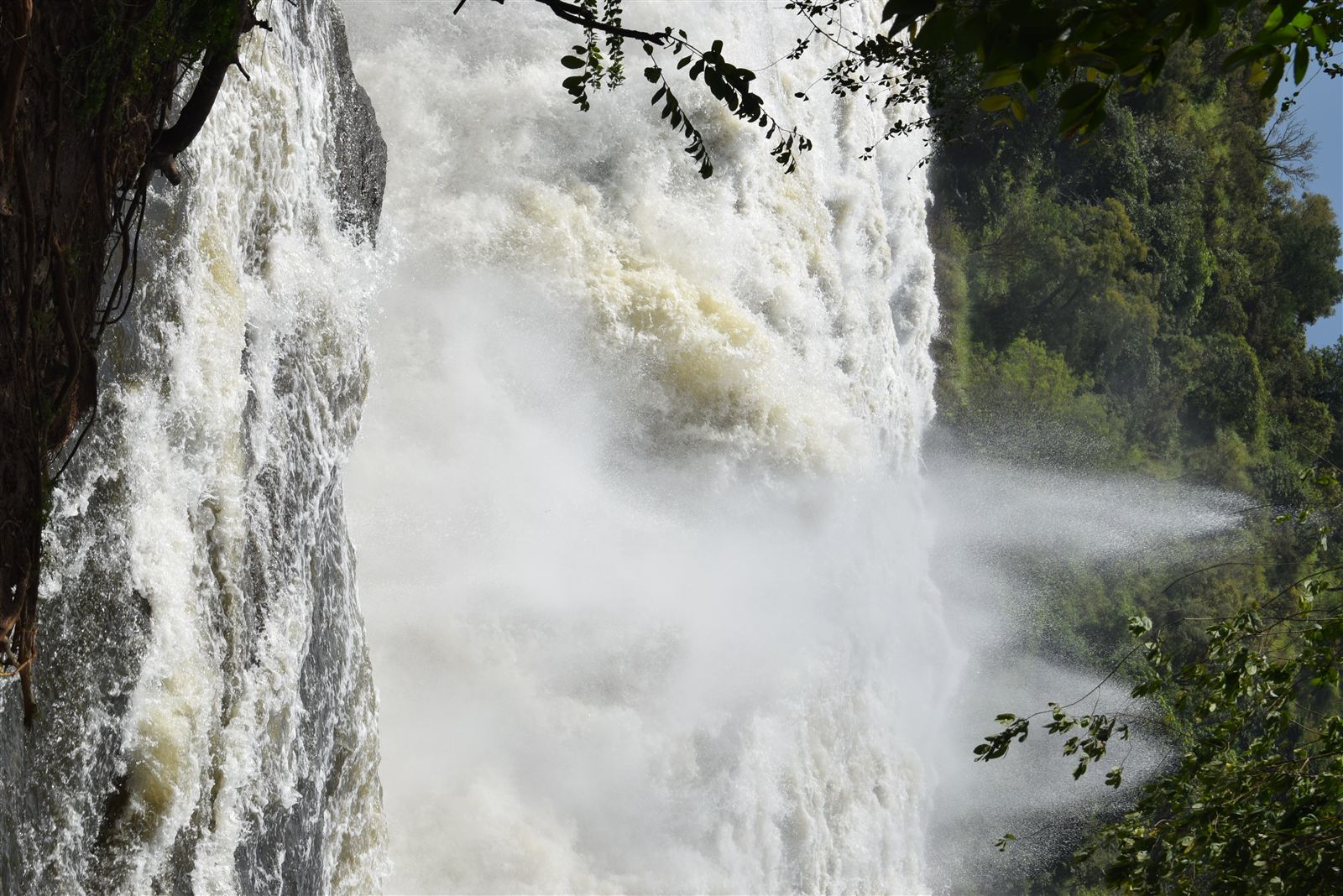
Sipi Falls, a series of three waterfalls on Mount Elgon’s eastern slopes, serves as one of the park’s most accessible and popular attractions, reachable without the multi-day commitment the full Wagagai summit trek requires. The falls area offers shorter day hikes, abseiling down the main fall, and access to the region’s renowned Arabica coffee farms, making it a strong choice for travelers who want a taste of Elgon’s scenery and culture without committing to the longer trekking routes further west. The main Sipi Falls itself drops roughly 100 meters in a single sheer plunge, and several viewpoints and lodges around the falls offer views across the falls toward the plains stretching out below, a dramatic panorama that draws day-trippers from as far as Mbale and even Jinja on longer weekend outings.
Trekking Routes
Three main routes climb toward Wagagai Peak: the Sasa Trail, the steepest and most direct; the Piswa Trail, longer but gentler; and the Sipi Trail, which combines access to the falls with a route to the summit. Each route passes through Elgon’s distinct vegetation zones, from montane forest through bamboo and heather zones to the high-altitude moorland near the caldera rim, giving trekkers a genuinely varied landscape experience over a typical four- to five-day round trip, with each night’s camp positioned at a progressively higher, cooler elevation as the vegetation thins toward the caldera rim. For a detailed look at the summit trek itself, see this guide to climbing Mount Elgon’s Wagagai Peak.
Wildlife and Birdlife
Mount Elgon’s forest zones hold blue monkeys, black-and-white colobus, and duiker species, along with a bird list that includes several Albertine Rift and East African highland endemics, drawing dedicated birders specifically to the park’s lower forest trails for a checklist quite distinct from Uganda’s savannah parks. Elephants and buffalo move through the lower forest, though sightings are considerably less predictable than in Uganda’s savannah parks given the dense vegetation and the animals’ wide-ranging territory across the mountain’s slopes. Leopards and hyenas are also present but rarely encountered given how thickly forested most of the park’s lower elevation remains, and serious wildlife-focused visitors should adjust their expectations accordingly, treating any large-mammal sighting here as a genuine bonus rather than the main reason for a visit.
The Caldera and High-Altitude Landscape
Mount Elgon’s caldera, formed when the volcano’s summit collapsed inward following the exhaustion of its magma chamber millions of years ago, ranks among the largest intact calderas anywhere in the world, and trekkers reaching Wagagai Peak walk along its rim rather than a conventional summit point. Within the caldera itself, hot springs bubble up through the high-altitude landscape, a striking contrast against the cold temperatures typical at this elevation, and the giant lobelias and groundsels found in the moorland zone give the upper mountain a genuinely otherworldly character shared with only a handful of other East African peaks including Rwenzori and Mount Kenya.
Coffee and Bagisu Culture
The lower slopes of Mount Elgon support some of Uganda’s most celebrated Arabica coffee farms, benefiting from the volcanic soil and altitude that make the region ideal for high-quality bean production. The Bagisu people who farm this land have cultivated coffee here for generations, and several community-run farm tours near Sipi and Kapchorwa let visitors follow the process from cherry to cup while learning about the region’s culture more broadly, including the Imbalu circumcision ceremony, a significant rite-of-passage tradition performed in even-numbered years that remains central to Bagisu identity. Visitors present during a ceremony year sometimes have the opportunity to witness the public celebrations that accompany the ritual, a genuinely rare cultural window that most tourism itineraries elsewhere in Uganda never offer, though visitors should approach any such encounter with appropriate sensitivity and follow the guidance of a local host or guide familiar with the customs involved rather than treating it as a casual photo opportunity.
When to Visit
Mount Elgon’s dry seasons, roughly June through August and December through February, offer the firmest trails for both the multi-day summit trek and shorter day hikes around Sipi Falls, reducing the mud and slippery conditions that can make the mountain’s steeper sections genuinely challenging during the rains. The wetter months bring lush, dramatic scenery and noticeably fewer trekkers on the trail, though visibility from the caldera rim can be more limited during periods of heavy cloud cover, a consideration worth weighing for trekkers specifically hoping for clear summit views.
Getting There and Practical Planning
Mount Elgon National Park is most commonly accessed via Mbale or Kapchorwa in eastern Uganda, roughly four to five hours by road from Kampala. Travelers interested primarily in Sipi Falls and the coffee culture can base themselves in Kapchorwa for a shorter, less demanding visit lasting anywhere from a single day to a comfortable long weekend, while those attempting the full Wagagai summit trek need to arrange multi-day logistics including porters, camping equipment, and a UWA-registered guide well ahead of arrival, ideally weeks rather than days before the planned climb dates. Budgeting realistically for porters, camping fees, and multiple days of guide time is essential for the full trek, since underestimating these costs is a common planning mistake among first-time Elgon trekkers comparing prices against the shorter, cheaper Sipi Falls day-trip option. For current park fees and trekking permit information, the Uganda Wildlife Authority publishes up-to-date pricing for both the caves and the trekking permits, and this guide to Sipi Falls covers the eastern approach and its coffee culture in considerably more depth.
Comparing Elgon to Uganda’s Other Mountains
Mount Elgon offers a genuinely different mountaineering character from Uganda’s other major peaks. The Rwenzori Mountains demand technical glacier navigation on their higher routes and carry a considerably higher altitude and difficulty profile, while Elgon’s volcanic caldera terrain, despite its own significant elevation, involves a steadier, less technical ascent that makes it accessible to a broader range of reasonably fit trekkers without specialized mountaineering experience. This distinction matters for travelers deciding between the two: Elgon suits those wanting a serious multi-day trek with genuine reward but without the technical demands and higher cost of a full Rwenzori expedition, while Rwenzori remains the choice for trekkers specifically seeking Uganda’s most demanding and dramatic high-altitude experience, complete with glaciers, afro-alpine bogs, and the genuine mountaineering logistics that come with attempting Margherita Peak.
Border Considerations
Because Mount Elgon straddles the Uganda-Kenya border, with a twin national park protecting the Kenyan side of the same volcano, trekkers should confirm with their guide or operator exactly which side of the mountain their planned route covers, since permit systems, trailheads, and park fees are managed entirely separately by the two countries’ respective wildlife authorities despite the shared geological feature. Most Uganda-based itineraries stay entirely within the Ugandan park’s boundaries, but trekkers with a specific interest in the Kenyan side’s own trails and attractions should treat it as an entirely separate booking process rather than an extension of a Ugandan permit, since the two parks’ ranger stations, fee structures, and even trail maintenance standards can differ meaningfully despite sitting on the same mountain.